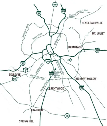
When you’re driving around the Brentwood area (or if you’re looking for a place to live in Brentwood, TN), it can get confusing as to what is actually in Brentwood and what is not.
The boundaries (as seen on this map of Brentwood, TN) are a little strange and somewhat unclear, so it’s easy to refer to something as being in Brentwood when it’s really not.
Here’s a satellite view of Brentwood Tennessee on Google Maps.
For assistance with this, I frequently refer to a comment we received from David Andrews awhile back.
He wrote:
Many of the locations you are referring to as Brentwood are not actually in Brentwood.
- The U.S. Postal service extends the 37027 postal code into Davidson County, however, no part of Davidson County is in the Brentwood City Limits.
- Old Hickory Blvd. is in Davidson County, as are all businesses in or near the Target shopping center.
- The northernmost edge of Brentwood is Walgreens on Franklin Road at Old Hickory Blvd. Actually, Walgreens and Corkys are in Nashville. All of Old Hickory Blvd is in Nashville.
- Nippers Corner is nowhere close to Brentwood, as the city limits on Edmondson Pike don’t begin until the curves south of Holt Road.
Just FYI as many people are confused as to the location of Brentwood’s unusual city boundaries. Thanks.
— David Andrews
More About Brentwood TN City Limits
![]() Official City Of Brentwood, TN Website
Official City Of Brentwood, TN Website
![]() Reasons To Buy A Home In Brentwood, TN
Reasons To Buy A Home In Brentwood, TN
![]() What You Need To Know About Living In Brentwood, TN
What You Need To Know About Living In Brentwood, TN


